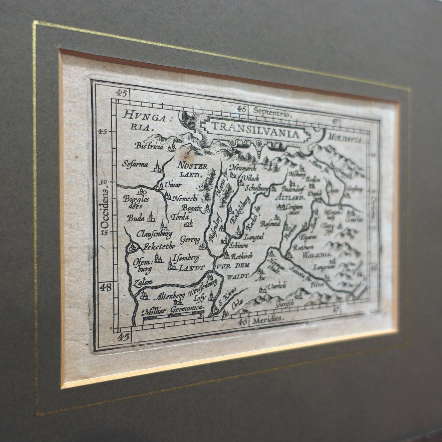
A 16th century Miniature map of Transylvania from Ortelius’ Epitome du Theatre du Monde
Probably by Philip Galle, after Frans Hogenberg
France; ca. 1577
Approximate size: 9.5”H x 11”W x 3”D (frame); 3.26”H x 4.6”W (print)
A map of Transylvania from Abraham Ortelius’ Epitome du theatre du monde, a smaller, more popular version of the large-format atlas of Ortelius’, Theatrum Orbis Terrarum. Published from 1570 onwards, this pocket atlas, suitable for travelers and students, contained small, high-quality maps like the present example. The work was created at the initiative of Ortelius’ friends, the engraver Philippe Galle and Pieter Heyns, with the first French edition dating from 1588. The publication continued to be reprinted by various publishers through to the 18th century. The present example is an old example, probably cut from an early 17th century copy.
Just prior to its publication, Transylvania was part of the Eastern Hungarian Kingdom and had recently become Transylvania in 1570 through the Treaty of Speyer. During most of the 16th and 17th centuries, the principality was a vassal state of the Ottoman Empire until the Hapsburg monarchy took control of the region in 1690.
Transylvania is better known in pop culture as the home of Dracula where the author Bram Stoker placed the fictional character who is based upon the historical figure of Vlad Tepes whose home was truly in Wallachia rather than Transylvania.
Condition commensurate with age. Minor age spots along the surface. Trimmed sheet but with generous margins. The frame is modern but features minor chips and nicks along its edges and/or corners.
Shipping is included in price.